Keressétek a Csúcsrajárás alkalmazást a Google Playen!
Túráink közül
Heukuppe
(2008-05-10)
2008.05.21 A Rax-Alpok egyik legmagasabb pontjának, a Heukuppe-nak a meghódítása:).
Mostanában
Adrspasske skály
(2024. október 12.)
Csehországi túra a kõvé vált óriások között
Lucní hora
(2024. október 12.)
Tavaszi - nyomokban téli - kirándulás az Óriás-hegységben
Elba-forrás
(2024. október 12.)
Megpróbáltuk felkutatni az Elba forrását a hó alatt, de ratrakkal kellett volna jönnünk
Dendeocse mászás
(2024. október 11.)
Újra a dendeocsén, de most már fel is mentünk a tetejére
Boncsos-tetõ
(2024. október 10.)
Nyári körtúra a Balaton-felvidéken a Boncsos-tetõ körül
Oberrothorn
(2024. október 10.)
Matterhorn-bámulós túra a Valais-i Alpokban
AK: Kismarja-Berettyóújfalu
(2024. október 10.)
Ide se jövök többet!
Répáshuta kirándulás
(2024. február 13.)
Õszi kirándulás a Déli-Bükkben Répáshuta környékén
Lillafüred kirándulás
(2024. február 13.)
Körtúra Lillafüred-Felsõhámor környékén barlangokkal, forrásokkal, kilátókkal.
Kasprowy Wierch
(2024. január 30.)
Nyári túra a Lengyel-Tátrában a Gáspár-csúcsra

Mittagskogel

Magashegyi túra
A leírást készítette: feherb
magyar english 
Idõpont: 2004. május 30.
Indulás: ~10.30 - Unteraichwald
Érkezés: ~20.00 - Unteraichwald
Résztvevõk: feherb, natasa, szabola
Túraparaméterek
A túra hossza16 km
Szintkülönbség1500 m
ÚtvonalUnteraichwald -> Bertahütte -> Mittagskogel -> Bertahütte -> Unteraichwald
HelyszínKarawankák
Legmagasabb tengerszint feletti magasságMittagskogel - 2142 méter
Idõjárás
Délután idõnként erõsen megnövekedett a gomolyfelhõzet, de emellett sok volt a napsütés és csapadék sem volt. Európa idôjárása
Magyarázat a térképhez
After our hike in Switzerland we gave Natasa a task: buy a turist map of the mountain region of the Karawanken and we would go for a climb there in the summer. She bought the map and we selected the path number 680 with that headed to the peak of Mittagskogel.
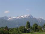
Mittagskogel from side of Worther lake
This path was fair, it started at about 600-700 meters above sea level, its length was approximately 5 kms, and its end was on the 2100 metre-high peak, which is, by the way, the second highest top of the Karawanken. The Austrian-Slovenien border runs along the ridge of the mountain, so the peak is on the border too.

Mittagskogel can be reached from the direction of Slovenia, but the path to the peak is harder. The Slovenian name of the peak is Kepa. The mountain looks like a volcano, its top is nice conical. The mountain can be seen from the A2 highway, and the Worther lake.
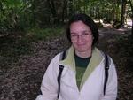
Natasa in pine forest
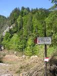
Signpost
We had to go only a small distance by car from our Klagenfurt accomodation to starting spot. We started too late. We left the car in an outlying parking place of a hotel with some fear, but we trusted in the poni horse in the backyard nearby, hoping it will snarl at everybody who dares to lurk around the Reanult with the plate number starting with an H. The landscape started with a pine forest, and we went ahead towards a speedy brook. The slope was harder for a short time. We glimpsed the conical top of Mittagskogel when we left the last pine trees, and our reaction was "whadafuck". The sight was beautiful. What a pity we won't be here at sunset, because it had a beautiful sight. Later we managed to returned here during the sunset, which only proves that we weren't aware of the amount of time needed for such a high mountain hike. The landscape had changed to plain then we continued our hike on a more and more steeper dirt road. We reached record heights, as we soon left the altitude of Kékes.
Panoramic view of Mittagskogel
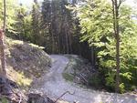
On the number 680 path

The road wound so wide, that a car would fit on it, but it was so steep that only the nearby hut owners could travel here by their extra special all terrain cars. The tourist path went off the dirt road, and we rose in a pine forest. We had been going for an hour, when I became thristy and I asked for some from the others. They would have had to provide for the water. As it turned out, the water bottle had been left in the car, so we had only a little water and warm, sour tee, but I didn't want that. We would survive somehow or other, I thought.
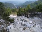
Rocky cove
Taste of melted snow is very bad
We met with the first snow at 1300 m, and more and more followed. A little higher we stopped at Bertahütte for longer time. This hut is located at foot of the mountain. The terrain became harder from here. We looked up to the cross on the top, which was 700 metres higher from our position, and just 1 km more. We had to go there. We followed the hiking trail number 680 on a thin path. The trail sign painters didn't care about the looks of the icons, somewhere a little red spot was on rock by way of sign.
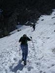
Meredek volt felfelé
But the density of them was very big. We crossed little snowfields, which were little pits covered with snow. Later we met larger fields to be crossed, but the path was invisible, so we followed the footprints in the snow. Soon we had to get over a short chained passage too, but these situations weren't dangerous. And then we reached the point from where snow was everywhere, the path hid under unknown depth snow. Probably it meandered, but we ignored it, and followed the footprints in snow. It was hard to hike in the snow. The worst was when my leaning leg slipped and I couldn't step a big enough step. It drained a lot of my energy. Lack of water started to be dominant, I ate snow in my agony, but it was cold and its taste was very bad. Moreover, it didn't have taste. The air was warm, I sweat like a horse when I had stood ankle deep in the snow.

Surrounded peaks
Eating on the rock
We stopped to eat something at a little rock. We looked back and saw the Drau winding in the valley, and behind the river there was the Worther lake behind a little hump. The altitude of this little hump was 800m by the way, but it seemed like a hump. These little humps don't have names here, and these are higher than Pilis.
Panoramic view toward the Worther lake
The weather was very nice, there were some little cumulus in the sky only, but they had been growing up manifestly. We had some fear, when we will have reached the top, we couldn't see anything because of clouds. We looked up and found what remained was a little but steep passage. I felt the resting and food didn't help me. As if air would have been less, but we were slightly over 2000 m. I didn't have ski sticks either.

We have climbed it!
The two lonely warriors
Finally we reached the ridge, where there stood a fucking huge POZOR sign that was the Staatgranze. Shortly after we arrived to the cross of Mittagskogel. There were lots of hikers. We had reached to the peak late, at about 4 pm, and realized we will have to return back to the car before sunset. We made a couple of panorama photos. We were lucky, because all of the other peaks of the Karawanken were in clouds and clouds covered the 2800-metre-high Julian Alps too in Slovenia. On the Slovenien side of the mountain there were some verdant fields with a little brook. This little brook was the Sava. The other side of Mittagskogel Drau wound, we could see Faaker lake and Villach, easter was the Worther lake and the shape of Klagnefurt at the other end of the lake.

Downward on the dirt road
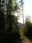
Downward in forest
We melted some snow in top of our thermos-flask, and ate something (as it turned out we had a bag of chocolate cookies). After eating, some a sort of black birds flew around us and ponced breadcrumbs, it was a Hitchkock moment. We went back on the same route, what we had came up. We got on fast in snow, but when we reached the rocks we slowed down. Fortunately this rocky passage wasn't very long, and the terrain in the pine forest was the same as in Hungary, but it was steeper and rockier. We reached the point of desperation that even if we had to spend millions of euros, we would buy a coke in Bertahütte. The piss warm water was waiting for us at the car. By the way Natasa read somewhere, that the surface waters are drinkable in Karintien. So we had tasted a creek, and we survived. When we left Bertahütte, the sun had set behind the mountains.
We were the last guests in the hütte. We hurried up a little, and we went on the dirt road easily, and we made very good pictures of Mittagskogel in the sunset. The knees of Natasa were in pain, because goind down was not easy, although snow helped the advance. On the last slope she could only stumble. Szabola made some pictures from a creek in sunset light.

Zöld zóna
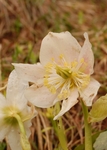
Helleborus niger L.
Fekete hunyor
(Helleborus niger L.)